
A city can lower the temperature a satellite sees and raise the temperature a person feels. That is the tension through this week’s research debate and the conversation with V. Kelly Turner on the What is The Future for Cities? podcast. Episode 471 works through her 2022 paper with colleagues, More than surface temperature: mitigating thermal exposure in hyper-local land system, set in Civano, Tucson. Episode 472 asks what a city should do once it stops treating heat as one number on a weather app.

A cooler pixel can be a hotter person
The debate’s sharpest picture is a street painted white. Land surface temperature falls. The sunlight does not vanish. It bounces into the space where people walk, and mean radiant temperature at midday goes up. The hosts describe a 54.4 degree Celsius swing in mean radiant temperature across a day in those microclimates. A few metres from an open street into a shaded courtyard changes the burden on a body.
Landsat’s 30 metre pixel, often from a pass near 10:00, averages the glaring roadway and the shaded path into one colour. One side of the debate defends that map as the tool a poorly funded city actually has. The other calls planning from it alone a path to maladaptation. Both can be true at different scales. A regional map still shows where asphalt holds heat into the evening. It does not tell you whether the person at the bus stop is safe. MaRTy, the field cart in the study, looks up, down, and sideways. A satellite looks straight down.
Ask which heat
Turner borrows the American Meteorological Society’s definition. Heat is a verb, a process of energy exchange. A temperature is a snapshot. The weather app mixes air temperature and sometimes humidity. A surface you cannot touch is another snapshot. Sunlight on skin, and heat leaving a wall, are others, and a body has trouble separating them from the air.
Thermal literacy, in her words, is a working knowledge of why you feel hot, how you cool down, and why a city heats and cools. She hopes everyday people and local governments learn to deal with the problem in a wholesale way. Until then, “manage heat” hides the choice. She calls the urban heat island a caricature: a tidy city, hotter than its rural edge in the evening. Desert suburbs can show the opposite, where irrigation makes cool islands inside the urban area. A downtown that looks hot on the map can feel cool in building shadow. A green lawn can look cool from above and feel brutal in full sun.
Shade changes the work a body does
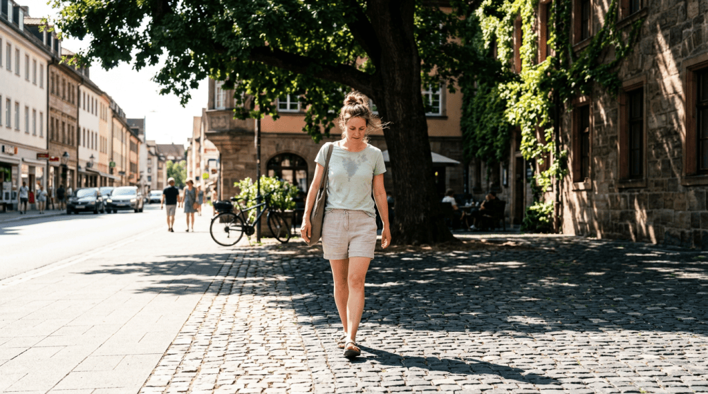
Her second concern is that cities have been designed to produce heat. Shade, she says, has the largest cooling effect on a person outside, large enough to be metabolically significant: it reduces the work the body does to cool itself. It only works inside the shadow. We stopped designing for that once air conditioning made the indoor alternative easy.
The research episode reaches the same point from the street. Shade blocks the sun before it hits the person and before it charges the asphalt, the night-time thermal battery. A dense canopy can also act like a blanket after sunset, trapping heat that bare soil would have sent to the sky. Trees are not a magic night-time fix. The question is where people stand at the hottest hour.
The three Ps she names with colleagues in thermophysiology put that choice on a person: who you are, the place you are in, and what you are doing. A healthy adult, a small child, a pregnant person, and someone running rather than walking are not the same job for a cooling plan. A blunt “stay inside” alert throws away the more specific instruction. Move recess to the morning. Walk in the sun and run in the shade. That is how an ordinary day, a school morning or a late soccer game, stays possible.
Cities are mutable
Turner refuses the idea that built form is finished. An old street grid may be worth keeping. Almost everything else can be retrofitted, and that is where she finds optimism. Cities are also a manageable size for rules. She has watched the City of LA and Los Angeles County write heat action plans with staff who know their cities and now know heat.
She notes that if one place held about 40 percent of the population for up to 60 hours a week, we would cool it without argument. We do not say that about schools, because we file children as a niche. Older people draw the headlines. Children carry a quieter risk, because thermal conditions sit under learning and growth, and the gap between thermally safe and unsafe childhoods will be hard to measure later.
Heat never had the institutions that fire and stormwater have, so cities are scrambling: expensive consultants, chief heat officers, action plans. She still sees a chance to build those institutions with equity in them. California’s Extreme Heat and Community Resilience program pays communities to plan and learn in public. Even a shade sail over a playground can nearly double in cost when disability-access rules attach to the upgrade. Heat is local, and it is not only local.
Agency is not a private duty
On a hot night she would cross-ventilate, cover the windows by day, and use less air conditioning so the grid and the household bill both ease. She is careful about the next sentence. Agency slides easily into “this is your problem.” She calls heat a collective challenge.
The public tools she names are ordinary and unfinished. A maximum safe indoor temperature for renters, not only a minimum for cold. Breaks, shade, and water for workers. Drinking fountains people can find. European cities, she found, treat public water as normal. In the United States it is still hard to know which fountains work. One reliably cool room in the places people use most. At the Luskin Center for Innovation the working phrase is heat exposure settings: home, work, school, transit, each place matched to the rule that governs it. A tree in a schoolyard and a tree in a median are not one project.
Her own role, she says, is the bridge. Decision-makers are drowning in maps. The useful question is the one they already have: what problem do you need to address? Then build the tool around that.
The week’s episodes (471R and 472I) do not ask you to become a meteorologist. It asks you to notice which heat you mean, and who is standing in it.
What would you want your city to guarantee on the next dangerously hot day: a cooler map, a shaded place to wait, or a home that is safe to be in?
Next week we are investigating last mile delivery and retail automation with Laetitia Dablanc!
Share your thoughts – I’m at wtf4cities@gmail.com or @WTF4Cities on Twitter/X. Subscribe to the What is The Future for Cities? podcast for more insights, and let’s keep exploring what’s next for our cities.
If you would like to support the podcast, check out the Building Better Cities book or our Patreon!


Leave a Reply